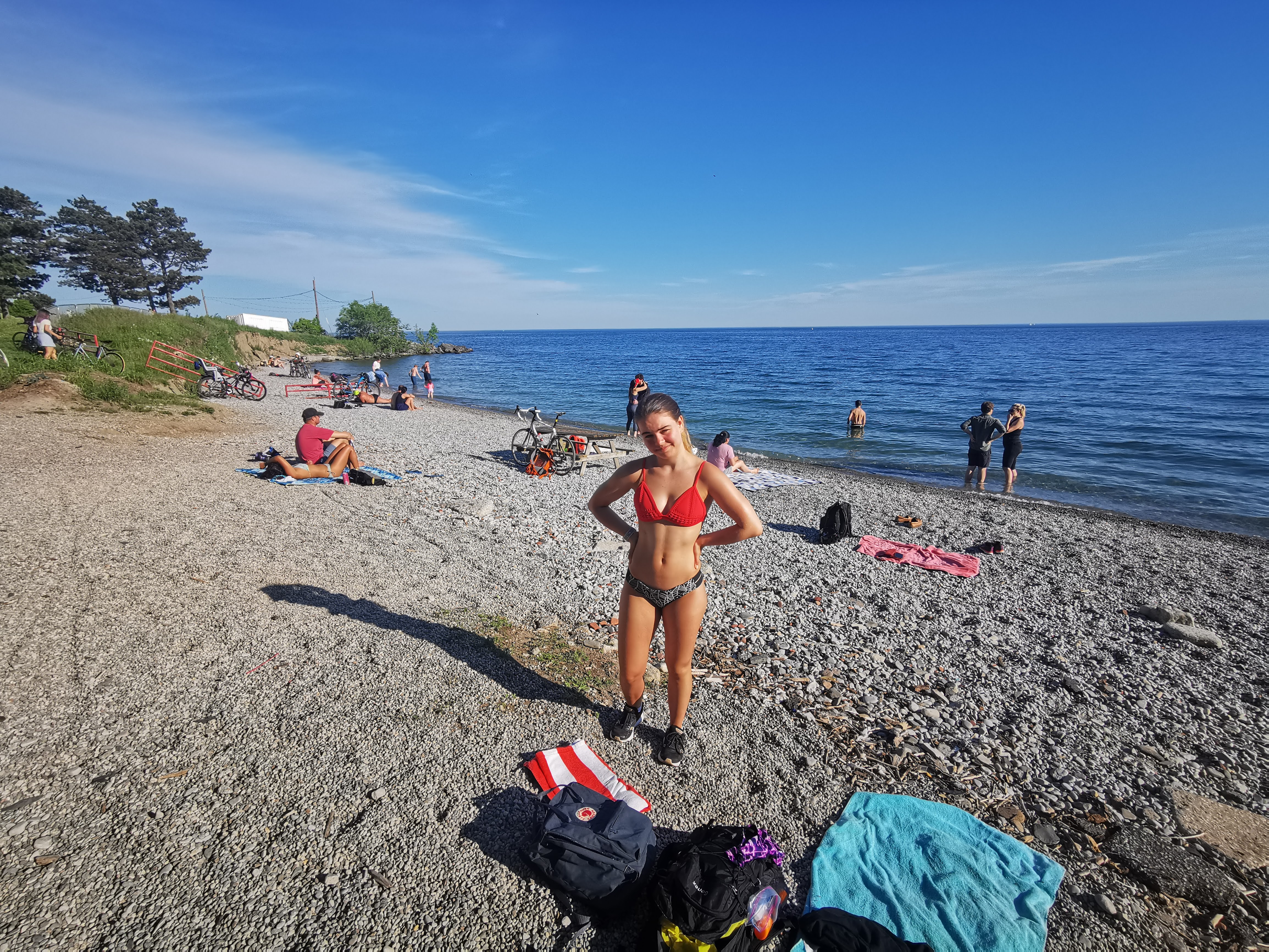
Downtown Toronto's only beach, 43.627506, -79.421038
43°37'39.0"N 79°25'15.7
43.627506, -79.421038
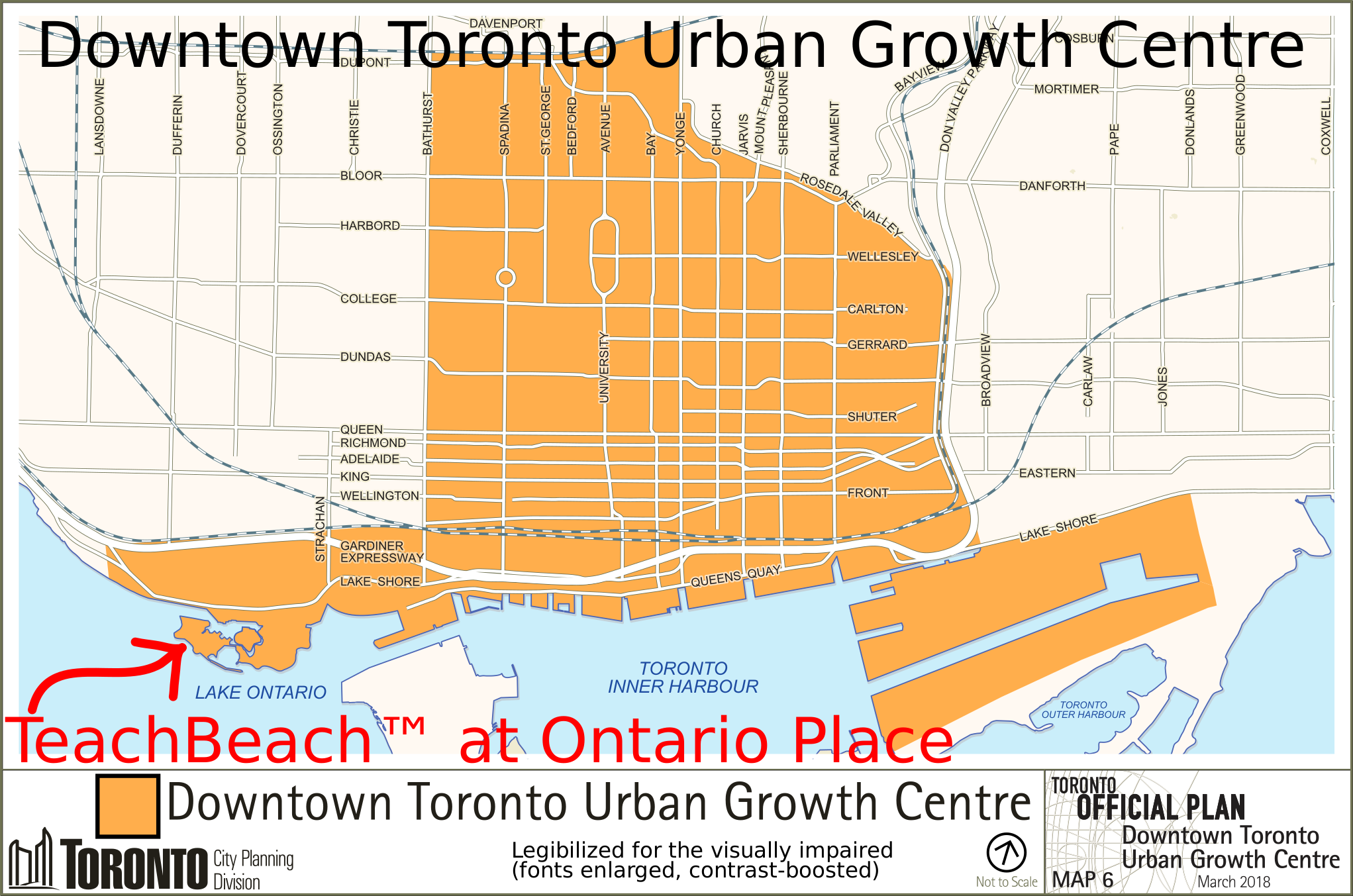

We call it Ness beach, or Ness island beach, or the hydraulophone beach, Ontario Place Beach, or Just oBeach (Ontario Beach)...:
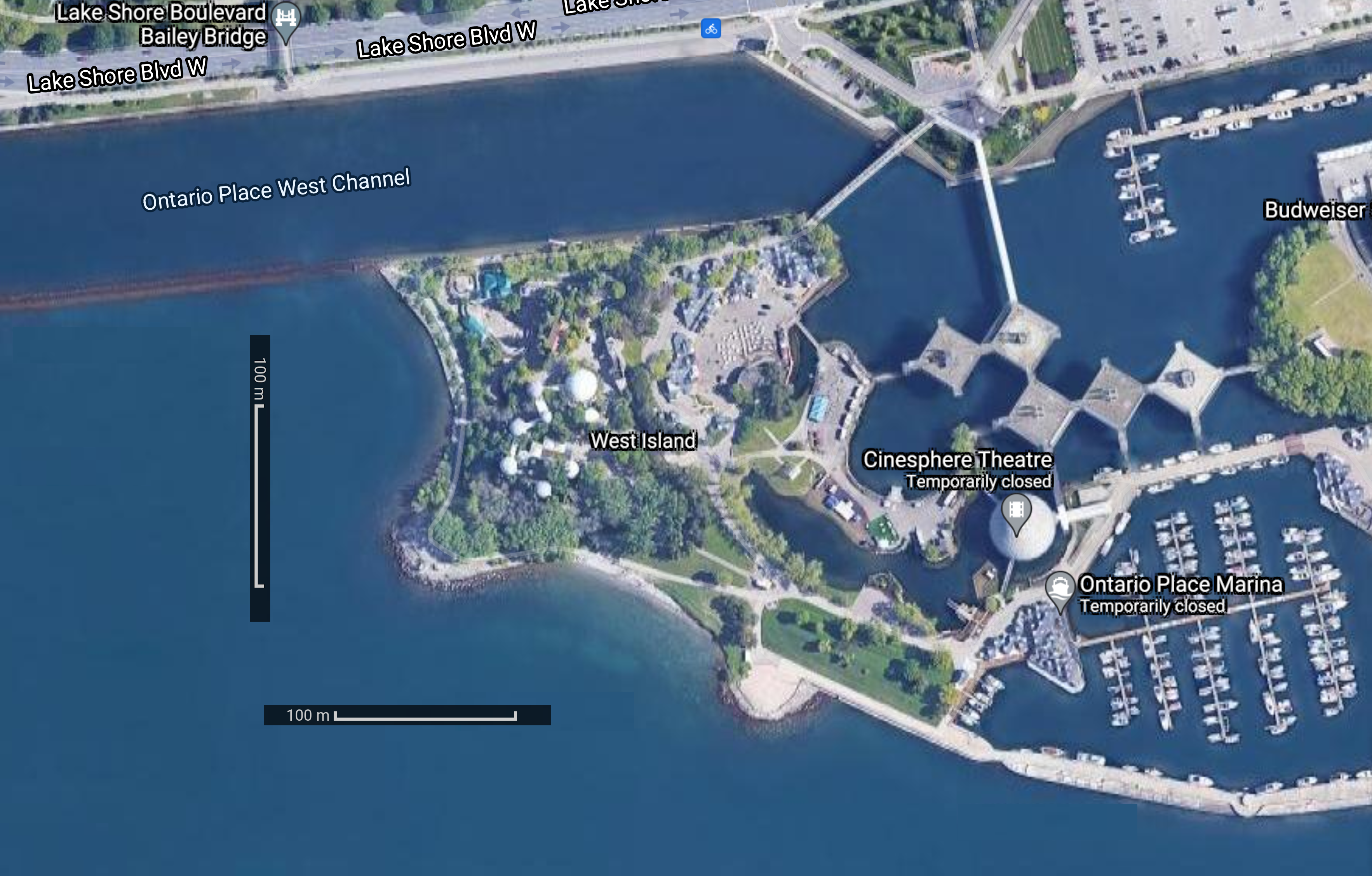
Here's a map:
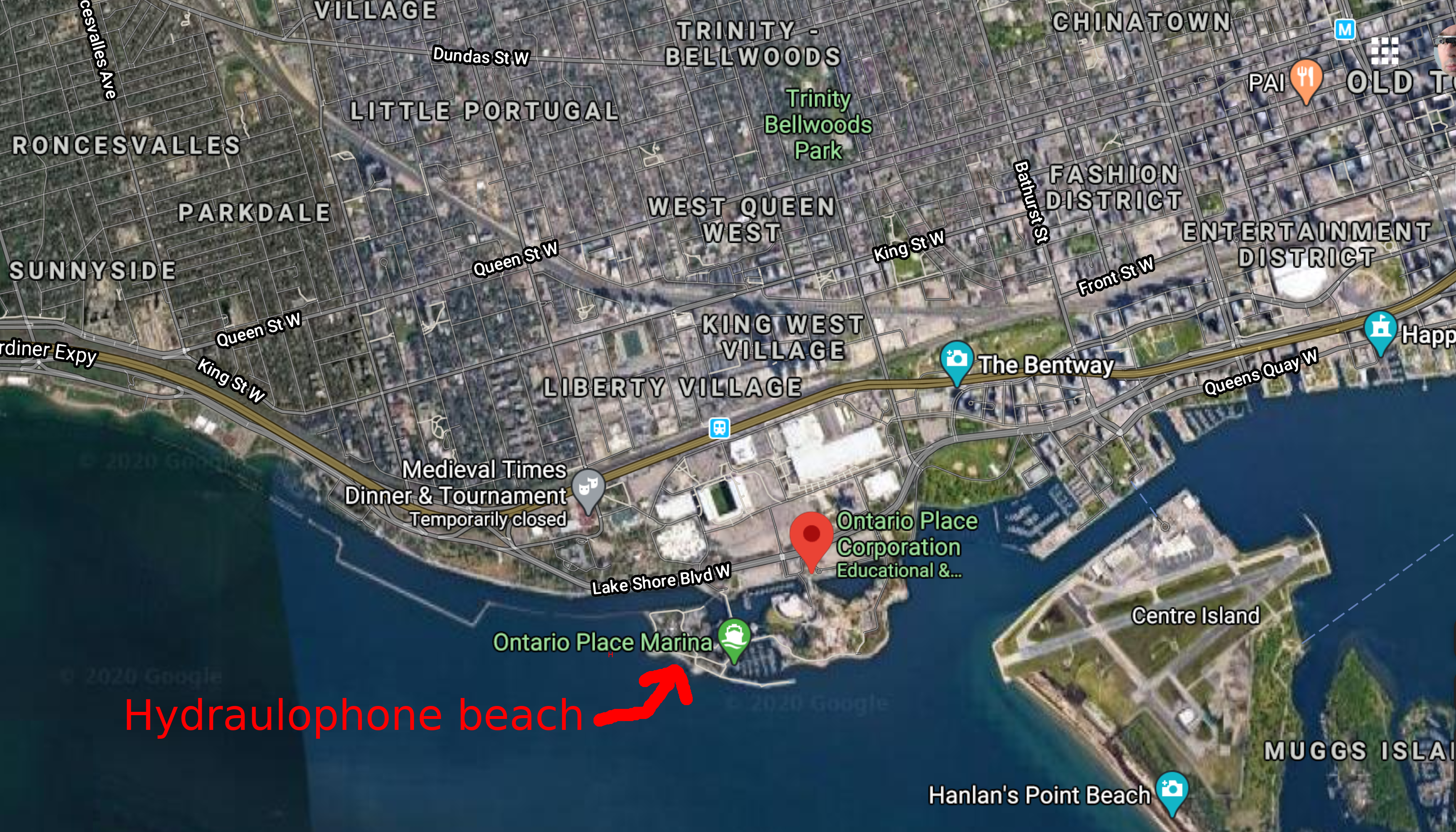
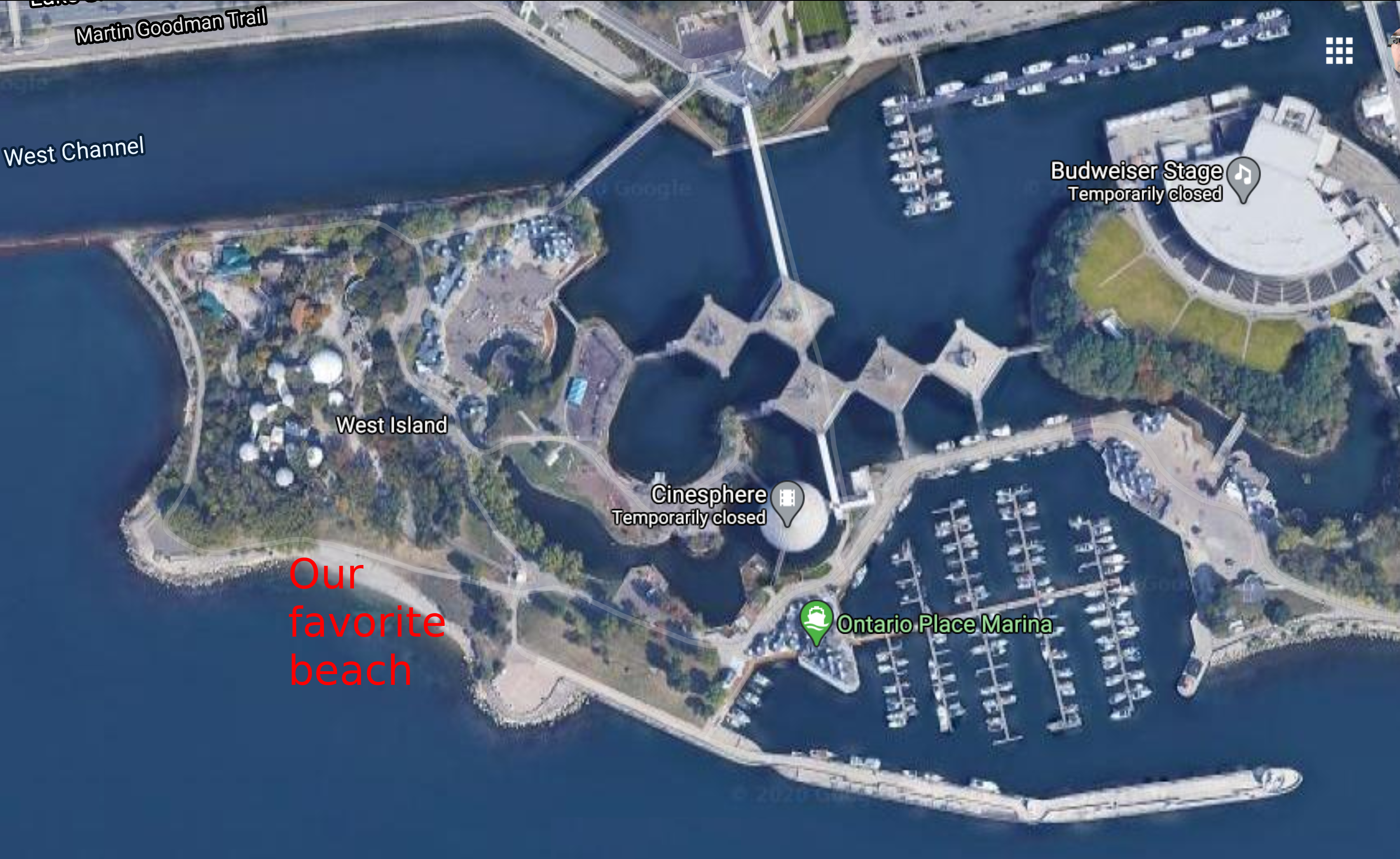
Here's a closeup of the map:
We've created a
Facebook page called "SwimOP = Swim at Ontario Place":
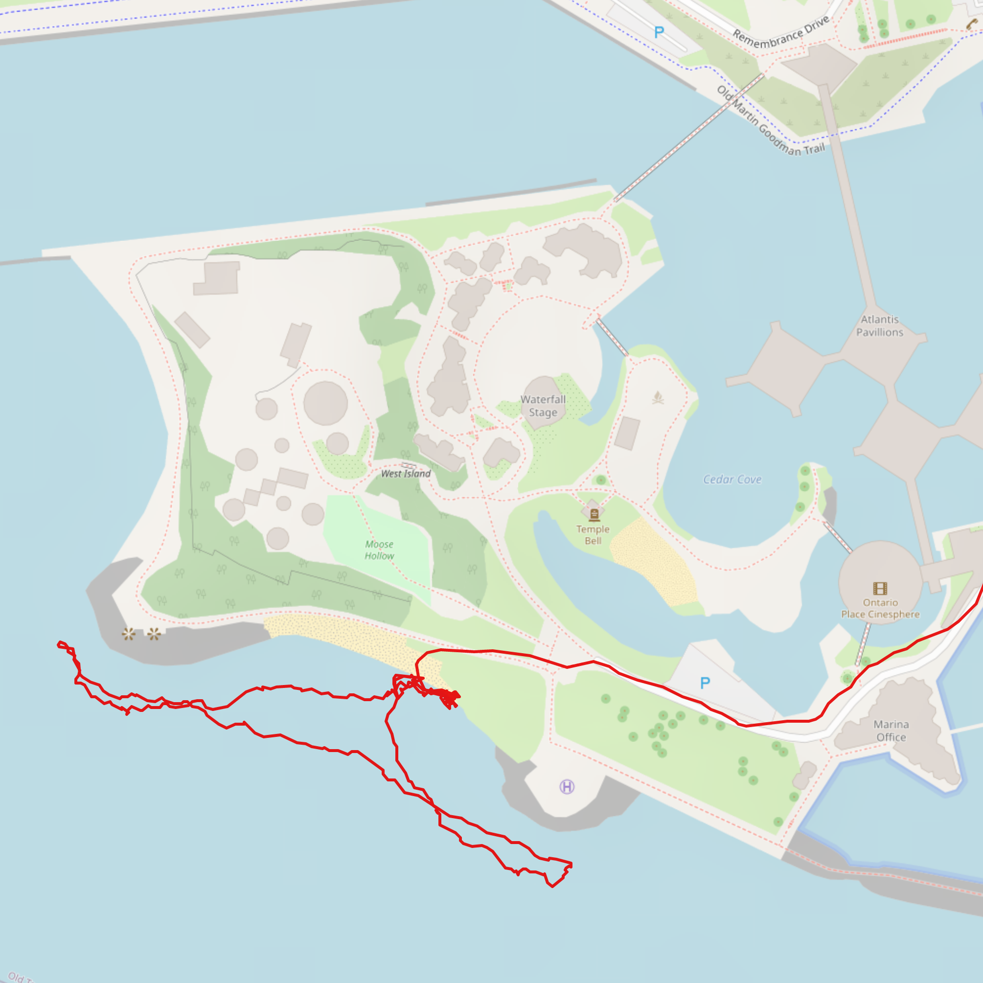
When running there we take whichever route makes the traffic lights easy, e.g. generally South West from our lab,
so we'll choose South or West depending on the traffic lights, so our route is hard to predict; here's one possible route
from Google maps:
It usually takes a bit more than 20 minuts to run there.
Historical perspective:
Many years ago, there were plans for 4 beaches at Ontario Place:

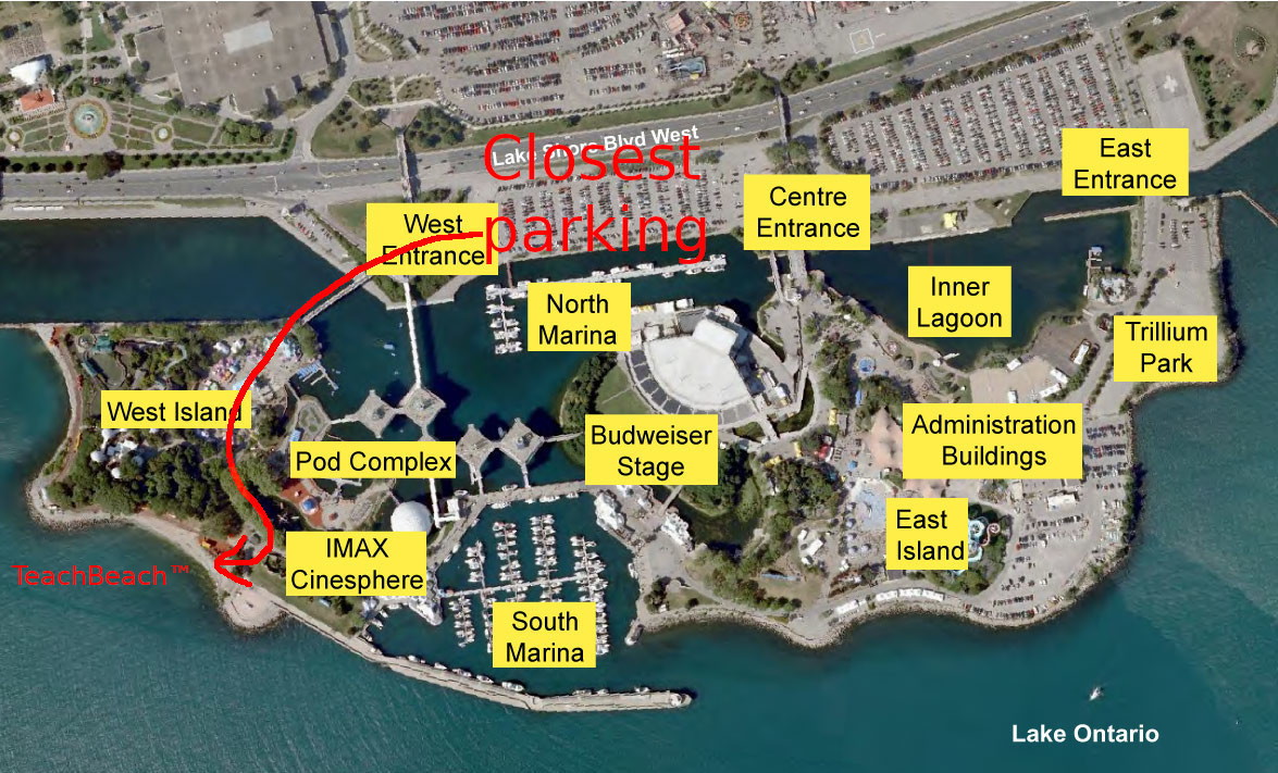
Parking
Closer parking lot (closest to beach):
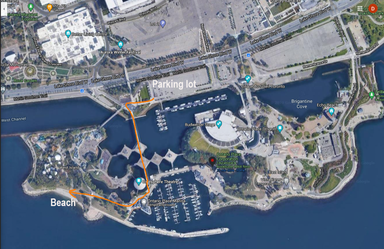
Sometimes there is a film production crew blocking this access, so here's
an alternative path to the beach:
Mission and research:
SwimOP's goal is to:
- promote safe swimming in downtown Toronto in service of
PAM (Physical, Affective, and Mental) health; and
- do advocacy work to keep downtown Toronto's only beach accessible to all people at all times of the year (in the face of privatizing forces that seek to maximize profits off of Ontario Place).
Here's a recent IEEE research paper we wrote:
SafeSwim: Overhead vision to help people see better by Steve Mann, Christina Mann, Faraz Sadrzadeh-Afsharazar, Zhao Lu, Jiten Saini, Jacqueline Lian, MannLab Canada, Toronto, Ontario, Canada, M5T 1G5.
See also Safety first...
